Oakland to Chicago – Ottawa, KS to Florissant, MO
Denis Kertz, ©2001
Day 42: 10/12/2001,
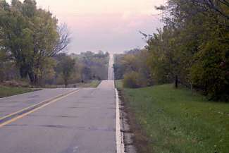
Friday - Ottawa, KS to Harrisonville, MO (pop 7,683) [60.2]
I was up
a little earlier than normal, not having slept particularly well, and I ate at
the Country Kitchen. I often find these
restaurant chains offer bland and over priced choices but the skillet with
pancakes was pretty good. The weather
prediction was not encouraging with showers likely in the afternoon and almost
certainly at night. I headed out just
before 9:00, heading north a couple of miles through downtown Ottawa and then
picked up 68 east to my destination, Harrisonville, Mo.
It was
quite overcast in the low 50s. The
route resumed the long rollers I had yesterday. Again, a couple times I broke the 20 mph barrier. It was 35 miles to Louisburg, population
1,964, the last town before the state line.
As I traveled I occasionally felt some fine mist. When I reached Louisburg the misting
increased and I considered whether I should stay or continue the 21 miles to
Harrisonville. However, the decision
was easy, as Louisburg had no motel even though it was at the junction of US 69
and 68.
 So I grabbed a quick sandwich and
pushed on. In 4 miles I crossed into
Missouri where 68 turned into Highway 2.
I had hoped that my home state would shower delights on a favorite son
but 2 was a mess. The almost
non-existent shoulder was cracked and virtually unusable. Then 2 jogged north for a short distance and
when it turned east again I was hit with my friend, the headwind. Fortunately the headwind was short-lived and
not an issue.
So I grabbed a quick sandwich and
pushed on. In 4 miles I crossed into
Missouri where 68 turned into Highway 2.
I had hoped that my home state would shower delights on a favorite son
but 2 was a mess. The almost
non-existent shoulder was cracked and virtually unusable. Then 2 jogged north for a short distance and
when it turned east again I was hit with my friend, the headwind. Fortunately the headwind was short-lived and
not an issue.
2 was
reasonably flat and I made good time.
As I neared Harrisonville the weather seemed to improve a little as the
overcast lessened a bit. When I hit
town at 2:30 I took the southern route through town but didn’t find the
services I expected. After inquiry I
found I had to head north where I found the motels. I found a motel a little off the main business route for $32.
After I
cleaned up I walked to another buffet restaurant I found while looking at a
different motel. Another filling meal
for $7.27. Afterwards, the sun was
shining and it was clearing up, no doubt because I took my rain gear with me
when I walked to the restaurant.
Day 43: 10/13/2001,
Saturday - Harrisonville, MO to Sedalia, MO (pop 19,800) [81.3]
When I
signed into the motel yesterday the proprietor told me they served breakfast
from 6-9:00 so I checked it out and it was hardly anything. So I walked back to the buffet place since
they had a buffet breakfast on the weekend.
Afterwards
I checked the weather on TWC. It had
rained overnight and it was heavy overcast with possible rain through early
afternoon. So I packed up and hoped for
the best. I left shortly after 9:00 and
headed south on 2 through town and then east on 2. There was initial climbing to get out of town and then it was
rollers. On one of the rollers I broke
30 mph, the first time since the Rockies.
My
destination for the day was Sedalia, home of the Missouri state fair. I stayed on 2 rather than trying some back
roads to head to Sedalia more directly.
This gave me some possible bailout options if rain developed.
As I
moved out the rollers became steeper. I
might have needed my granny except the climbs were short enough I could build
up speed on the downhill and power up the hill without bothering to shift
chainrings. After I passed the junction
with 13 the rollers eased up quite a bit.
Early in
the ride I couldn’t help but notice I was moving pretty well and I was shocked
to discover my friend the headwind had abandoned me in favor of a
tailwind. It was a modest 5 mph but
considering the typical 5+ mph headwind the net effect was at least 10 mph.
 Around 1:00 after 54 miles, I
pulled into Windsor. I was surprised to
see a sign for the Katy Trail State Park.
The Katy Trail is a hiking/biking trail of fine crushed rock that runs
to St. Charles on the western edge of St. Louis. I knew about the Katy Trail but thought it began in Sedalia. Instead it starts in Clinton, about 16 miles
southwest of Windsor. While I checked
out the route display, another guy was taking pictures of the area. He appeared to be thrilled to have a Real
Cyclist with a real touring bike in the pictures.
Around 1:00 after 54 miles, I
pulled into Windsor. I was surprised to
see a sign for the Katy Trail State Park.
The Katy Trail is a hiking/biking trail of fine crushed rock that runs
to St. Charles on the western edge of St. Louis. I knew about the Katy Trail but thought it began in Sedalia. Instead it starts in Clinton, about 16 miles
southwest of Windsor. While I checked
out the route display, another guy was taking pictures of the area. He appeared to be thrilled to have a Real
Cyclist with a real touring bike in the pictures.
Before
continuing, I rode downtown to check out the library, which was small and had
no Internet access. After that I
noticed a Subway so I stopped for a sandwich.
There were several people ahead of me so I waited in line. There was a mother with a couple of
youngsters who couldn’t make up their mind what they wanted on their
sandwich. Then when the woman had to
pay she didn’t have the necessary change so she had to walk out to her car to
get it.
I
figured that was the long wait with only two young women ahead of me. Then I noticed one had a piece of paper that
turned out to be an order list and the other woman ordered 3 subs. At that point I lost my patience and walked
out. I rode to a Casey’s where I got my
sandwich in 30 seconds.
Around
2:30 I set off on the Katy Trail that conveniently went directly northeast to
Sedalia as opposed to the right angle approaches the regular roads would have
required. The trail was cool as I had
it to myself except for a couple of cyclists.
There was no traffic to contend with and it was very peaceful and quiet,
a relaxing ride. The only thing that
would have been better would have been a paved trail. The packed trail was fine but not as smooth as pavement and it
was a little soft in a few spots, probably due to recent rains. For the most part, trees bordered the trail
on both sides and fallen leaves covered much of the trail. Occasionally the trail broke into the clear
giving nice views as it cut between farm fields. A nice relaxing way to ride into Sedalia.
In
Sedalia I rode into town to a railroad station where I wanted to check the
trail map. There I ran into 3 kids, two
7-year old twins and their 13-year-old brother on their bikes. They were fascinated with all of my gear and
especially with my helmet mounted rear view mirror that I claimed prevented anyone
from sneaking up on me from behind.
They asked endless questions and I assured them I had everything I
needed to stay anywhere. When they
asked where I was staying, I asked if I could stay with them but they said they
were already too crowded at home. Then
they wanted me to stay at the station and one of the twins kept blocking my way
with her bike. Eventually I had to do
some dodging and sprinting to get away or I would still be there.
It took
me a while to get my bearings even with the Sedalia city map in my state
map. First I found Broadway (US 50) and
headed east but found there weren’t any motels. So I headed west and then south on US 65 where I found a motel
for $34. After checking in I ate at a
Chinese buffet a short walk from the motel.
After having gone over 5 weeks without a buffet, I now couldn’t eat any
place except at a buffet.
Day 44: 10/14/2001,
Sunday - Sedalia, MO to Cooper's Landing, MO (pop 0) [71.3]
I packed
up to leave for breakfast and as soon as I was outside, locked out of the
motel, it started raining. I looked up
in the sky and there was a dark cloud above but it was moving east so the rain
only lasted a few minutes. Then I rode
a short distance to a Golden Corral with a breakfast buffet and filled up.
When I
left I couldn’t remember exactly where the Katy Trail ended in town so I had to
hunt it down but that didn’t take long.
However, the train station was the end of the trail in town so I needed
to find where it picked up on the east side.
I found a small map on the bulletin board that seemed to indicate it was
just 3 miles east on 3rd street but that wasn’t the case as 3rd
street dead-ended shortly. So I started
heading north and found a sign for the trail direction. With just a little zigzagging I was back on
the trail.
Actually
the Katy Trail wasn’t the most direct route to St. Louis, as it headed
northeast to Booneville before heading southeast to Jeff City. US 50 went directly from Sedalia to Jeff
City but I decided I wanted no more of US 50 so I chose to stay with the Katy
Trail. Along the trail I found a sign
giving the history of the trail. The
Katy Trail is a rails-to-trails conversion of the MKT (Missouri, Kansas, Texas)
railroad that ceased operation in 1986.
This sign showed Sedalia and St. Charles as the end points so the
Clinton extension was apparently relatively new. Knowing this was a rails-to-trails also told me there would be no
significant grades and it would be pretty flat.
 Like yesterday trees lined the
trail for the most part. In many places
the trees formed a canopy over the trail.
At Pilot Grove I was lucky enough to find a map of the trail that was
very helpful. I continued on to
Booneville and rode into town where I found the library was closed on Sunday as
I expected. I stopped at a Casey’s for
refreshments and saw another cyclist nuking a burrito but I didn’t need to as I
was still powered by the breakfast buffet.
Like yesterday trees lined the
trail for the most part. In many places
the trees formed a canopy over the trail.
At Pilot Grove I was lucky enough to find a map of the trail that was
very helpful. I continued on to
Booneville and rode into town where I found the library was closed on Sunday as
I expected. I stopped at a Casey’s for
refreshments and saw another cyclist nuking a burrito but I didn’t need to as I
was still powered by the breakfast buffet.
Continuing
I rode across the Missouri River, on the Booneslick Bridge, that the trail
would parallel to St. Charles. On the
other side the trail opened up to views of farmland as it passed through
Franklin and New Franklin. Franklin was
a supply point for the Sante Fe Trail in the early 1800s until the Missouri
flooded it and folks moved to higher ground, and naming the new town New
Franklin.
Now that
it was a pretty nice Sunday afternoon on a mid-October fall day I started
seeing folks hiking and biking. This
was especially true as I neared Rocheport that had bike rentals and a trailside
café. It also didn’t hurt that this
section was particularly scenic as it was right along the river with high
limestone cliffs on the north side of the trail. There was enough traffic that I could imagine a lot of traffic
during the summer.
At one
point there was an option to take another trail to Columbia and I gave some
consideration to visiting my alma mater and a nephew and a niece currently in
school there before continuing on. It
was just a little late in the day to be able to make Columbia and hunt down my
nephew/niece before darkness.
Near
Easley I stopped at a place called Cooper’s Landing (http://katytrail.net/cooperslanding)
that had camping and a small store. I got a campsite for $5 and showers for $2
and later the owner, Mike, fixed me a chicken meal that was very appreciated
since there wasn’t much food left in his store at the end of the season.
When I
first stopped at this place I met Jim, working on his touring bike. Jim was from Kansas City and wrapping up his
summer/fall cycling after riding the Transamerica Trail from Portland to
Virginia with an Adventure Cycling group.
After Virginia, Jim turned around and rode solo back to here where he
was hanging out for a few days. We had
a lengthy discussion about touring that lasted well into the evening and also
involved Mike, the owner.
Now that
my travel plans were pretty concrete, I called my brother Andy to warn him of
my impending St. Louis arrival and asked for email directions to his and my
other brother Ed’s home.
Day 45: 10/15/2001,
Monday - Cooper's Landing, MO to Hermann, MO (pop 2,754) [66.9]
I didn’t
wake up until 7:45 because I didn’t get to bed until 11:00. It was overcast and Jim told me the forecast
was for heavy rain. I went inside the
store and Mike showed me the weather radar picture. It showed a problem over the Kansas City area but not yet in
Columbia.
I was
offered a cup of coffee but I declined in order to get on the road and,
hopefully, outrun the rain.
Fortunately, Mike let me use his PC to check my email and I got
directions from Ed to his home in Ballwin so I didn’t have to worry about
finding Internet access along the way.
 I was on the road by 9:00 in the
overcast cool day. I passed several
camping places as I left. As I passed through
towns I looked for a grocery store so I could replenish my food supply but
didn’t find any. In Hartsburg I
discovered I had just missed the Fall Pumpkin Festival by a day but I did find
a bike store/café that promised breakfast.
Unfortunately, it only had simple food so I had coffee and a muffin.
I was on the road by 9:00 in the
overcast cool day. I passed several
camping places as I left. As I passed through
towns I looked for a grocery store so I could replenish my food supply but
didn’t find any. In Hartsburg I
discovered I had just missed the Fall Pumpkin Festival by a day but I did find
a bike store/café that promised breakfast.
Unfortunately, it only had simple food so I had coffee and a muffin.
I didn’t
linger over “breakfast” so I could keep moving. I assumed it was going to rain and the farther down the road I
was when it did the better. When I
passed through North Jefferson I could see the state capital in Jeff City
across the river.
At one
point I came upon 3 dogs that looked like beagles. They seemed content to let me pass until one started barking and
then they all had to join in with one giving a half-hearted chase. Later I encountered another beagle but he
apparently thought I was after him and he started running down the trail ahead
of me. Every few steps he would turn
his head back and bark at me. For some
reason I just wasn’t scared and rather amused until he turned off onto a side
road.
Not long
after Jeff City it started an occasional light drizzle. Just when I thought it would turn bad it
would ease up. This went on for a while
and then it started a consistent drizzle so I put on my rain gear for the first
time of the trip. The drizzle picked up
and became a fair rain with some wind.
I still had almost 2 hours to reach Hermann, the next place with a
motel. I made up my mind I was not
stopping until then even though I hadn’t eaten since breakfast, and not a
particularly large breakfast of cereal and a bagel.
My toes
and fingers were uncovered but they didn’t feel that bad although I knew I
couldn’t go forever in this rain with some wind and cool temperature of about
50 – a recipe for hypothermia. I saw a
restaurant in Rhineland but I passed it up and continued. At McKittrich I left the trail to pick up 19
so I could head into Hermann, another 2 miles but made easier by what was now a
tailwind as I headed south across the river.
The bridge over the Missouri was a narrow two-lane bridge so I had to
pretty much take my whole lane.
However, a posted sign warned trucks over 21 tons to limit their speed
to 15 mph so I pretended I was a 21 ton truck and kept my speed under 15 mph. Somehow I think the cars behind me didn’t
begrudge my taking the lane under the miserable conditions.
As soon
as I crossed the river there was a motel on my right. I continued a little further through downtown where there were
restaurants. Then I turned around and
got a room at the motel for $27. However,
my hands were so stiff from the chill and my iron grip on my handlebars that I
had trouble getting my gloves off. Once
I had my gloves off, I had trouble filling out my address and signing my name.
The
motel was rather decrepit even by my standards but it had a hot shower and I
was soon back to normal. After waiting
a while hoping the rain would ease, I put my rain gear on and walked downtown
in the light rain to find food. Hermann
is famous for its German heritage but most of the restaurants were closed on
Mondays so I ate pizza at a bar. The
pizza was OK and I chatted with a local at the bar. He guessed I was a cyclist but couldn’t believe I was traveling
alone. He was also somewhat inebriated
and rather boring so I didn’t stay very long.
Day 46: 10/16/2001,
Tuesday - Hermann, MO to Ballwin, MO (pop 21,816) [65.3]
When I
got up it was a much nicer day with the sun in the sky if a bit chilly. I walked downtown to the bar where I ate
last night because it also served breakfast.
I had pancakes and bacon that was pretty good.
Around
9:00 I left and crossed back over the bridge and stopped at a grocery store to
pick up some food. I started out on 94
to avoid climbing the hill to McKittrick to get back on the Katy Trail. I rode a mile or so on 94 until a side road
took me back to the trail.
Although
it was cool and I wore socks and gloves, the riding was fine with some
tailwind. After 10 miles the trail was
right next to the river for a few miles and there were some nice views of the
river. It was also nice not having to
rush to the next town to escape rain.
My goal for the day was to get to Highway 40 early enough so I would
avoid rush hour navigating my way to Ballwin.
 Officially I needed to exit the
Katy at Weldon Spring to 94, which would take me to Highway 40 and a bridge
across the Missouri. Practically, I
figured I could continue past Weldon Spring and finagle a way on to Highway 40
when it crossed the Katy. I was glad I
continued on the trail past Weldon Spring as the next few miles were very
scenic with high bluffs on my left and a marshy tree area on my right. Too late, it finally occurred to me just
before Highway 40 that it was going to have to be above the bluffs and high
above the Katy Trail.
Officially I needed to exit the
Katy at Weldon Spring to 94, which would take me to Highway 40 and a bridge
across the Missouri. Practically, I
figured I could continue past Weldon Spring and finagle a way on to Highway 40
when it crossed the Katy. I was glad I
continued on the trail past Weldon Spring as the next few miles were very
scenic with high bluffs on my left and a marshy tree area on my right. Too late, it finally occurred to me just
before Highway 40 that it was going to have to be above the bluffs and high
above the Katy Trail.
And sure
enough, I came upon the bridge and it was 100-200’ above the trail. I stopped two cyclists coming from the
opposite direction but they knew of no way to get to the bridge aside from
backtracking. Just past the bridge I
found an opening in a fence along the trail and started to push my bike through
the opening along an obvious footpath up the hill. However, the path was too steep and muddy so I backtracked to the
other side of the bridge and found a rough rocky road on private land that gave
me hope. It was too rough to ride so I
pushed my bike along the road and up a pretty steep hill. At the top I was above the bridge but
following the road brought me down the hill right to the bridge. This private, no trespassing road probably
saved me 10 miles of backtracking.
So I got
across the river and followed my brother’s directions to Ballwin. I stopped at a convenience store at one
point because I was uncertain about the directions and a woman inside asked
“aren’t you cold” and I said “no, but I may be lost.” So I got good directions to Baxter Road and had no trouble making
it to my brother’s house.
There I
met Ed and Jean and then they surprised me with the appearance of my older
sister, Dorothy, who was unexpectedly there.
We spent the evening getting caught up on news and talking on the phone
with my brother Andy to devise a route to his house for tomorrow.
Day 47: 10/17/2001,
Wednesday - Ballwin, MO to Florissant, MO (pop 51,206) [27.4]
I was
the first one up so I spent some time doing email. When everyone finally got up we had breakfast with coffee and
conversation. Shortly before 11:00, I
packed up, said my goodbyes, and was off.
I
retraced my route back to Baxter Road and headed east on Clayton Road to
141. 141 was a busy, 4-lane road but it
had a wide shoulder and the only problem was being careful at the entrance/exit
ramps. At Olive it was a short jog to
pick up Creve Coeur Mill Road and then Earth City Expressway. These roads often had no shoulder but
traffic was light and not a problem.
Then I had a short climb and picked up Riverview Estates that took me to
Howdershell and to my brother’s house.
I was
the first one home but I had the key code to get in the house through the
garage and cleaned up and waited for the others to arrive from work and
school. Today was Jill’s birthday so we
went out to celebrate and ate at a nearby sports bar/grill. Afterwards Jill gave me suggestions on how
to head out in the morning to get across the Missouri and Mississippi Rivers at
Alton.
![]()

![]()
Copyright
Denis Kertz, 2001. All rights reserved.