Southern Pacific Crest
Trail &
Fall 2010
Denis Kertz, ©2010
Day 26: Fri, Oct 01, 2010 - Casa Grande , AZ to Douglas ,
AZ
I stopped at a McDonalds on my way out of town to grab a quick bite for breakfast. Since I wasn't riding I had no need for a large breakfast.
I picked up I10 to  At one time it was feared that the saguaro
was going to die out in the park but has been making a comeback in recent
years.
At one time it was feared that the saguaro
was going to die out in the park but has been making a comeback in recent
years.
After leaving the
park I headed east on I10 and then took 83 south since it was labeled as a
scenic route and it was scenic but somehow zipping along the road in a car just
wasn't the same as a slow-paced bicycle ride.
At Sonoita I took 82 east to
I rode south to
Bisbee which is built on the hills of the
The country was
very scenic from the time I left I10 on 83 to
Day 27: Sat, Oct 02, 2010 - Douglas ,
AZ
I left Douglas
headed for
In
When I reached the
intersection with 12 I took it to Datil.
During this time it became rather cloudy and threatening in spots. At Datil I took 60 west, another road I had
ridden on another tour in 2006. In about
20 miles I reached
I had to do a little double take because Kathy looked somewhat older than I recalled in 2006 but I introduced myself and she mentioned that she thought I looked familiar although I could imagine she was just saying that. I would have looked somewhat different in 2006 dressed out in my cycling attire and wearing a helmet.
When I got to the cafe it wasn't that busy but by the time I left it was packed. This place did have a sparse menu of other items besides pies but pies were obviously their specialty. As an added bonus, the place had used books and I was able to trade the first paperback I had read for another one. This was good timing since I was nearly done with my second paperback.
As I headed west on 60 I passed the other cafe where I was forced to have my pie in 2006. It had only a single car parked in front so it wasn't doing the booming business that the Pie-O-Neer was.
A little further I
picked up 36 and then 117 on my way to Grants.
I passed along the El Malpais National Monument that had some limestone
bluffs that were impressive including an arch.
El Malpais is Spanish for “the badlands” although they didn't look that
bad from the road. I stopped at the
Sandstone Bluffs Overlook that required a little climbing on the rocks but
afforded a great view of The Narrows, a stretch of 500 feet high sandstone
cliffs, and the surrounding countryside.
It was near 5pm
when I reached Grants, about 60 miles from
Day 28: Sun, Oct 03, 2010 - Grants, NM to Rio
Rancho, NM [24.3, 2:12:16, 11.0 mph]
I woke up around
6:30 and was surprised to see bright daylight.
Then I remembered that I was about 300 miles east of
Dropping off my
rental car at the airport was uneventful. The bicycle went back together without a
hitch. When I had everything out of the
car another rental customer quizzically asked if “is all that stuff going to
fit on the bike.” I assured her it
would. Then she asked if the bike was
hard to pedal and I said only when going uphill and she laughed.
The bicycle went back together without a
hitch. When I had everything out of the
car another rental customer quizzically asked if “is all that stuff going to
fit on the bike.” I assured her it
would. Then she asked if the bike was
hard to pedal and I said only when going uphill and she laughed.
I left around
11am. I was actually well located in 
I rode the trail to
its termination at
I ate at another Subway and did some more grocery shopping at an Albertson.
It was great to get
back on the bike although it was also good to have two days of rest. Tomorrow's start of the ride to
Day 29: Mon, Oct 04, 2010 - Rio Rancho, NM to La Cueva , NM
I took advantage of the motel's continental breakfast. They had a waffle making machine so I had 2 waffles. Their choice of cereal left something to be desired so I used my own cereal.
I left a little
before 8:30 and there were a couple hot air balloons already further north than
I was. Then there were over a 100
balloons somewhere near the balloon park. I followed their progress for a while as I
rode north on 528.
I followed their progress for a while as I
rode north on 528.
After not too many miles I felt my rear tire go soft. When I stopped to fix it I checked the tire and found a piece of wire still stuck in the tire so locating the leak was easy. I patched the leak and put everything back together getting messy hands because I had to handle the chain. Unfortunately, the patch didn't hold and I could tell before long that the rear tire was going soft again. So I stopped at a McDonalds where I had some place to lean my bike while trying again. I ripped off the first patch and replaced it with another. This one held for the rest of the day but I probably spent about an hour on the two patches.
I picked up 550 north and left the hot air balloons behind. Other than one fairly substantial hill to climb it was pretty easy riding on a busy 4-lane road with a good shoulder. The scenery got better as I rode north. Just before turning off on 4 at San Ysidro there was a food mart so I stopped for a cold drink and a bite to eat.
4 was a fairly
narrow 2-lane road with virtually no shoulder but most of the traffic was
moderate speed and most of the traffic were very careful when passing me. 4 was very scenic as it wound its way through
the San Diego Canyon with steep red rock walls on both sides while following
the Jemez River upstream.
Along the way there was a visitor center that had forest service information. I inquired about campgrounds and learned there were a couple along my way just past the intersection with 126 although I had some question whether I would make it that far.
I stopped in Jemez
Spring, a small village of 375 with
La Cueva had a store, a cafe that was closed, and a lodge. I checked out the lodge even though I expected it would be expensive and the cheapest room was $75. After a cold drink I rode 2 miles further to the Redondo Forest Service Campground that I had learned about earlier. I was told it was open and had water and would not have been surprised to find it closed. It was open but it had no water.
The campground had
a host and he had what looked like a water tank at his site so I talked to him
after I paid my $10 fee. He said the
water tank was for him and his chores. I
inquired about the next water source and it wasn't promising. I had enough water to last the night and for
breakfast but I wasn't sure how much I would need for the ride in the morning
until I found another water source. I
learned that the host had lived in
My host mentioned it had rained last night and there was a bit of flooding through some of the campground including his site. He also said it was cold overnight, which is not too unexpected at 8,000 feet at the beginning of October. He said it was 41 in the morning and he was reluctant to get out of his sleeping bag. After an interesting discussion I retired to my site and ate from my food supply.
I made it further today than I expected. As a result I had about 1,000 feet of climbing tomorrow before a descent to Bandelier. However, I wasn't sure where I would be staying since the Bandelier campground was supposedly closed until next spring.
Day 30: Tue, Oct 05, 2010 - La Cueva , NM to Espanola ,
NM
It rained a little overnight but not much. It didn't get as cold as I expected for 8,000 feet in early October. I had breakfast in bed and left about 8:15.
My campground host had warned me that there was a lot of traffic for some reason early in the morning but by the time I left there was only occasional traffic. As I rode along there was a truck coming from the other direction putting out road divider cones. A little later a truck came from the other direction spraying the edge of the road and I guessed it was oil. Shortly my half of the road looked and smelled like it had just been oiled. A little later a pilot car came through leading a single vehicle. It looked like I had started just early enough to avoid all the mess.
I had about a
thousand feet of climbing left to reach the peak 9100 altitude so the riding
wasn't too bad. Just before reaching the
peak I rode past the Valles Caldera National Preserve, a large open meadow
formed by a volcanic collapse in the  This collapse spewed 500 times more debris
into the air than Mt St Helens eruption.
This collapse spewed 500 times more debris
into the air than Mt St Helens eruption.
After I reached the apex, it was a steep descent down to Bandelier. The steep part was curvy with some very tight turns so high speed was not an option. Then the descent lessened and it was mostly coasting the rest of the way where I encountered several cyclists riding in the opposite direction. There was a Bandelier group campground about 8 miles from the main entrance with a bunch of tents up.
What wasn't in question was the amount of time I had to spend in Bandelier. I had expected to be able to camp in the Bandelier campground in which case I would have been able to spend the afternoon in the park. Instead, I figured I could only spend about an hour and then I would have to be on my way.
The obvious way to
spend an hour was the main loop walk from the visitor center. This loop went by a couple of cliff dwellings
in the wall. However, it was pretty crowded and a lot of
the folks were either not in a hurry or not capable of moving very
quickly. So I did my best to worm my way
through the groups to see as much as I could as quickly as I could. I did get to climb a couple ladders to peek
into some of the cliff dwellings in the sandstone walls and that was about all
there was to see besides walking along the path. Nevertheless it was worthwhile to do this
simple loop and I finished in less than an hour. The aggravating thing was the return loop
went through a picnic area that would have been a fine place to camp
overnight. Instead, it looked like a lot
of the sites were being used as parking spots.
However, it was pretty crowded and a lot of
the folks were either not in a hurry or not capable of moving very
quickly. So I did my best to worm my way
through the groups to see as much as I could as quickly as I could. I did get to climb a couple ladders to peek
into some of the cliff dwellings in the sandstone walls and that was about all
there was to see besides walking along the path. Nevertheless it was worthwhile to do this
simple loop and I finished in less than an hour. The aggravating thing was the return loop
went through a picnic area that would have been a fine place to camp
overnight. Instead, it looked like a lot
of the sites were being used as parking spots.
Back at the ranch I wanted to get a bite to eat at the limited food place but it was obvious that was going to be slow so I decided I would wait until I got to White Rock, which turned out to be further away than I expected. So about 1pm I climbed back out of the canyon and the 3 miles back to the main road. Rather disappointing to be able to only spend an hour at this place.
It was a winding and up and down road leaving the park and headed to White Rock. It was about 8 miles to White Rock and when I arrived I saw that the single motel was a Hampton Inn, an upscale motel. I stopped at a food mart for something to eat since I hadn't eaten since my breakfast in bed. When I asked I was told Espanola was only about 11 miles and downhill. I believed the downhill part but when I checked my map it looked more like 20 miles and it turned out to be about 18 miles.
When I left White Rock still on Hwy 4 it seemed like all of a sudden I had entered a raceway. There was pretty heavy traffic and the road essentially had no shoulder. I checked my GPS and map to make sure I hadn't made a wrong turn but I was on the right road. A few miles later 4 ended and I picked up 502 east. This was a 4-lane road with lots of traffic but it had a very wide shoulder so it was at least safe riding.
In a couple miles I left 502 to take 30 north to Espanola. 30 also had a lot of traffic but also had a very wide shoulder. However, after a few miles I heard a noise and then a couple seconds later my rear wheel was flat. When I checked the tire I found a bit of embedded glass and suspected that was the culprit. But when I got the tube out it had a gash much bigger than the piece of glass I found so I probably ran over multiple pieces of glass. After my practice the other day I patched the tube and was ready to go in about 20 minutes.
However, while I was patching the tube I noticed the wind picked up and then looked back towards White Rock and saw some ominous clouds. So then it became a race of whether I could make the 8 miles to town before the rain. Looking back it was pretty obvious it was raining and I would almost surely have gotten rained on had I stayed in Bandelier.
The rest of the way to Espanola was easy. There was some tailwind and it was probably still a little downhill. There was also lots of traffic in my direction and I guessed this was rush hour since it was around 4pm.
When I got to town
I had to find the motels. My first
choice was in the wrong direction but a query got me pointed right and then I
found a Comfort Inn, Day's
While I was cleaning up it started to rain. There was a Sonic Drive-in immediately next door so with the rain this was the obvious choice for dinner.
Day 31: Wed, Oct 06, 2010 - Espanola , NM to Taos ,
NM
I got up fairly
early because I figured I had a pretty hard day ahead, taking the High Road to
I left a little after 8am and picked up 76 going east. This wasn't a great time to be on that road. There was a fair amount of incoming traffic and the road didn't have a shoulder. On top of that I was riding right into the morning sun which meant the drivers coming up behind me could potentially have trouble seeing me but I lived to ride another day.
The first 8 miles or so was kind of in a country suburban area with houses fairly frequent. There were also a lot of dogs and I heard dogs barking to note their objection to my passing. Of course these dogs were either chained or behind a fence so they didn't bother me. That is, until I heard a couple dogs that sounded pretty close and looked over my shoulder to see two dogs on my rear wheel. They didn't appear to be in attack mode so I just yelled back at them to note my objection to their objections. Seeing those dogs initially was an adrenaline boost.
This road starting climbing gradually from the moment I picked it up. I stopped at one scenic overlook and met another couple who said they saw me yesterday at Bandelier. From this point on the climbing started in earnest. Overall I had to gain about 3000 feet to the maximum altitude but because of some of the ups and downs I was guessing it was about 4000 feet of climbing. There were two major climbs, the first one to Truchas and then a later one.
The climb to Truchas was steep and on top of that there was road maintenance. In a couple places there was hard packed dirt in preparation for paving which added to the climbing difficulty. When I neared Truchas I could see the homes stretched out along a ridge. Truchas earned fame as the site of Robert Redford's “The Milagro Beanfield War”. It now has gained renown as an artist colony and that was evident by seeing the gallery signs passing through the town.
What I was hoping the town would have was some place to get a cold drink where I could have my second breakfast. There was a small store but even though its sign claimed open it was closed. So I headed out of town for a short ways until there was a turnout with a sign explaining the Truchas Peaks. The sign had a couple posts that were suitable for a place to sit, especially since there wasn't anything else around.
So I broke out my breakfast cereal and settled down for some food and some needed rest after the difficult climb. The turnout was next to a field that had a grazing horse and the next thing I knew the horse was at the fence staring at me. Maybe he was hoping to have a second breakfast too.
After my needed break and refueling I continued on. The road had some short descents and ascents to add to my climbing total. After a while I was hoping for a cold drink. Every time I saw a group of buildings I hoped it was a small town but nothing showed up. Finally, when 76 ended at 75 there was a small store where I got my cold drink and an ice cream.
The weather
forecast for
At Penasco 75 took a hard left and I climbed up through a valley. That's when it seemed my rear wheel was getting a little squirrely. So I stopped and checked and my rear wheel was getting soft. I stopped and pulled out the tube but I couldn't find a leak. So I pulled out my remaining good tube and put it on. While I was working a car came along from the opposite direction and pulled over next to me. I assumed it was someone who was checking to make sure I was okay but it was a local from Truchas. He said he saw my pass through Truchas earlier. Now he told me about some of his bicycle touring and his desire to do another one but he had a bad back. This was all interesting and in normal circumstances I would have welcomed the exchange but I was trying to get my bike back together. Finally he moved on and I got back on the road.
Just after starting
again I did a u-turn on 518 and started the second major climb. However, this one was a little easier than
the first one, taking about an hour to climb maybe 4 miles. Just over the top there was a turnout with a
nice view of the mountains near  Then it was a fun descent the rest of the
way. There were a couple steep sections
where I was able to turn the bike loose and hit 40 mph on one section. There was a car trailing me at that time and
I would guess he might have been surprised how fast I was moving since he
didn't pass me when he could have.
Then it was a fun descent the rest of the
way. There were a couple steep sections
where I was able to turn the bike loose and hit 40 mph on one section. There was a car trailing me at that time and
I would guess he might have been surprised how fast I was moving since he
didn't pass me when he could have.
Beyond the steep
sections it was easy pedaling the rest of the way with a great shoulder. I got lucky and pulled into
There was a Taco Bell almost a mile away so I set up my tent, unloaded my bike, and rode back to the Taco Bell for a couple inexpensive burritos. Back at the park I took my two leaky tubes and used the basin in the men's bathroom to find and fix the leaks. The first tube that I had an issue with a couple of weeks ago had a slow leak so I knew I would need water to identify the leak. But the tube that flatted today had an obvious leak and I'm surprised I wasn't able to find it on the road.
After fixing the leaky tubes I cleaned up and rinsed out my day's riding clothes. The park had a laundry room so I used the dryer to dry them out. The park also had WiFi but I was unable to get it to work. I wasn't sure if there was some incompatibility or I had a weak signal but that was a disappointment.
Day 32: Thu, Oct 07, 2010 - Taos , NM to Red River ,
NM
I slept in late, not getting up until 7am. I checked out the two tubes I patched yesterday and they seemed to be holding up fine. As I was getting ready to leave I guy walking his dog approached. He grew up in the Sierras and told me he had biked all around the Sierras when he was younger and he still had his bike attached to the back of his RV.
I was actually
about 2 miles south of
It was almost 9:30
by the time I left town. Today marked
the start of part of the
Once I picked up
522 to Questa I was riding in a wide open space with sage brush and mountains
in the distance, a nice change from pine forests. There was a descent to the Hondo Arroyo and then
I had to climb out of the arroyo. More
climbing followed and then a fast descent to Questa, a small town where I
stopped for a bite to eat. I nuked a
burrito and had a couple Gatorades to prepare me for the climb to Red Rock.
There was a descent to the Hondo Arroyo and then
I had to climb out of the arroyo. More
climbing followed and then a fast descent to Questa, a small town where I
stopped for a bite to eat. I nuked a
burrito and had a couple Gatorades to prepare me for the climb to Red Rock.
I took 38 at the
intersection in town to
Just outside town there
was an RV park with camping that I later learned was closed. When I rolled into town there was essentially
just a main road with services all along the road. It didn't take long to figure out that
I stopped at the visitor center to get accommodation information and learned that motels were $50 and up and the RV park with camping was closed. The visitor center had WiFi so I spent some time using it. When I was done around 3:30 it was clouded up and looking like it was going to rain. I rode around perusing the motel possibilities and waited out a little rain. I eventually settled on a motel at $59 which I was told was the off season rate, $20 less than normal. According to the motel proprietress it had been a very slow off season.
Surprisingly, there weren't a lot of food choices. Some places were closed, possibly because there wasn't enough business to be open. My first choice was a pub but it was closed so I ended up at an Italian place. I didn't want a full meal so I had a hamburger where I got spaghetti as an option to fries. I also had a beer with the meal, the second time of the trip.
Back at the motel I decided to make my Amtrak reservation to get home. Earlier at the visitor center I had checked pricing and had come up with $221, $181, and $145. The $221 was for purchasing a ticket the same day. The $181 was for Saturday night and the $145 was for Sunday night. For some reason I assumed Sunday night was cheapest because that would be the least desirable night. The Amtrak Southwest Chief left La Junta at 8:16 and I expected to be in La Junta Sunday afternoon. So I went ahead to purchase that ticket and was surprised to find it cost $181. Then I realized it was just after 8:16pm and that I was getting the more expensive ticket because I was buying it less far in advance. Bummed by just missing the 3 day advance purchase I went ahead anyway. Then things got real slow during the process and I eventually just gave up.
Day 33: Fri, Oct 08, 2010 - Red River , NM to Cimarron ,
NM
Over night I
decided to go ahead and book my ticket reservation. I figured I could wait until
Then I packed up while in a good mood and when I opened the motel door to leave I was surprised to see the cloudy sky and the drizzle. It looked like a layover day might make sense but my ticket committed me. At first I was going to ride my bike to breakfast but I realized that was stupid because I could keep it in the motel and walk to breakfast and I didn't have to check out until 10am.
I walked a block or so to Shotgun Willy's Cafe and there was a glimmer of hope with a small patch of blue in the southwest, giving hope that clearing was a possibility. The cafe was kind of a dive with just a long room with tables on both sides of an aisle. You ordered at the counter and picked up your order when called. I had the Willy Special which was eggs, bacon, sausage, potatoes, and biscuits and gravy with coffee for $6. They didn't have pancakes but did have french toast but I still went with the special. It was the bargain breakfast value of the trip so far.
Just after I ordered and sat down to wait for my order about a dozen folks showed up. I was really glad I wasn't just a few minutes later. I got my order and took my time eating since the longer I waited the more likely the weather would clear. In fact, by the time I left there was some sunshine and it looked like full clearing was underway.
I left town close
to 9am and applied sunscreen, which I wouldn't have expected to need
earlier. My goal for the day was
As soon as I got to
the edge of town the climbing started.
In a short distance there was a good view of the town looking back. After almost 5 miles I reached the pass with
the last mile easing off quite a bit on climbing. Then the descent was great, not because of
the descent but because of the views.
There were 
With the road still
wet I was reluctant to descend very fast which was fine given the great
views. A little later there were views
of meadows and grazing cows and horses as I rode through the
I stopped in Eagle
Nest for my second breakfast at about 11am.
Then I picked up 64 heading east.
First I had a short, steep, winding climb out of the valley which gave
some nice views of Eagle Nest Lake, a reservoir created by damming the Cimarron
River, and the surrounding hills and mountains.
Then I descended through the  This was completely unexpected scenery and it
was really nice, especially since it was downhill and I barely had to
pedal. About an 8-mile stretch of the
canyon was part of the
This was completely unexpected scenery and it
was really nice, especially since it was downhill and I barely had to
pedal. About an 8-mile stretch of the
canyon was part of the
It was 24 miles
from Eagle Nest to
The tent site was no great shake but it was good enough. I set up, cleaned up, and ate at a little drive-in. After that I retired to my tent for the night.
Day 34: Sat, Oct 09, 2010 - Cimarron , NM to Trinidad ,
CO
It was fairly chilly in the morning, probably mid or upper 40s. I broke camp and rode to the historic St James Hotel which advertised a breakfast buffet for $7, a deal that sounded too good to be true. Along the way I passed a deer along side the road and spotted a couple more out in the field. As I expected the buffet was basic breakfast food with no pancakes, french toast, or pastries but that was no surprise given the low price. I got my fill of basic breakfast and some cereal in an impressive dining room in the hotel that was arranged with western artifacts, like spurs, hanging on the walls.
The
I left just before
8:30. On my way out of town I saw there
was another campground that would have had nicer campsites but not as well
located. The goal for the day was
Trinidad which was across the border in 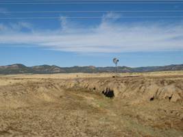
Cimarron’s great
claim to fame was that it was part of the Sante Fe Trail, 900 mile trail from
The most important
feature of today’s route was the climb from Raton to
A few miles before Raton I had to get on I25 for 3 miles. I took the first exit to Raton and passed a number of motels and a KOA so had I pushed on yesterday it would have been easy to find accommodations. I stopped at a food mart around noon for a burrito and a Gatorade.
Then I asked the attendant for the best way to get on I25, meaning to stay off I25 as long as possible before I would be forced back on it for the climb to the pass. I asked about a frontage road and I got directed to the frontage road which I doubt was the best route. I think if I had stayed on the Business 25 that I was on I would have avoided I25 for another mile or tow.
The climb to the
pass was a little uneven. It was hard but not the hardest climb. It was also the last climb of this tour
barring some surprise. The last mile was
the steepest part and I climbed it at 4mph.
It was hard but not the hardest climb. It was also the last climb of this tour
barring some surprise. The last mile was
the steepest part and I climbed it at 4mph.
The rest of the way
to
As I got closer to
I backtracked a bit
and picked up
Later I walked a
couple blocks to eat at the Trinidad Diner and had an okay fish diner. Then at 5pm I was able to watch the
Missouri-Colorado footbal game which
Tomorrow was a potentially hard day with the need to be at the La Junta train station to pick up the Southwest Chief at 8:16 pm with the ticket office opening at 6:45 pm. It was 80 miles to La Junta with no services along the way. I wasn't too worried about the distance because the route was downhill, losing 2000 feet of altitude pretty gradually along the route. However, at the diner I saw a paper which predicted north winds 9-16 mph and the route was northeast. So these would be some measure of headwinds which is what I didn't need. That made it more important to get off to an early start.
I bought some milk for my small refrigerator so I could eat breakfast in the room and not waste time eating breakfast at the diner down the street.
Day 35: Sun, Oct 10, 2010 - Trinidad ,
CO
I got up early because I wanted to get as early a start as possible. I had milk in the refrigerator so I had my cereal breakfast with some pastries so I wouldn't have to waste time waiting in a restaurant. It didn't get light until after 6:30 and I left right at 7am.
It was chilly with
the sun not out yet. All I had to do was
head east on
The scenery wasn't
exciting. It was plains as far as you
could see so it was just a matter of settling down and cranking out the miles. The route lost about 2000 feet which sounds
like a lot but that was pretty gradual when spread over 80 miles.
The route lost about 2000 feet which sounds
like a lot but that was pretty gradual when spread over 80 miles.
My two fears were weather and the head wind prediction I saw yesterday. The other potential problem was bike trouble. I was somewhat paranoid about getting a flat given the 3 flats I already had over the last week. I kind of thought there was little chance of a flat because the road had no shoulder for the most part, with almost no traffic, just something every few minutes. Usually the flat risk is due to riding on the shoulder and picking up debris such as a piece of wire or a piece of glass, both which happened during the last week. In this case I was riding on the road where vehicular traffic causes the road to be swept by the traffic to get rid of wires and glass. Or so I thought.
Early on I thought I felt the rear wheel was a little squirrely so I stopped and felt the tire pressure and it was okay although it seemed like it might be not quite as hard as when I checked at the motel. However, later I was pretty sure the rear wheel didn't feel right and when I checked the tire pressure was obviously lower. I decided to pump up the rear tire and hope it was just a slow leak that wouldn't require fixing. I managed 10 miles or so on the first pump and that would have been fine but the second pump only gave me about 6 miles. That told me the leak was getting worse so I stopped at a bridge where I had some shoulder and where I could lean the bike up against the railing.
What I found when I pumped up the tube was not only the leak but some abrasion. So I matched the trouble spot against the tire and it matched where the tire had been cut by glass when I was riding to Espanola. When I looked inside the tire I could see how the inside was causing some abrasion leading to the leak. I think the thumping due to road cracks yesterday and this morning had caused the tire to deteriorate. I patched the tube and figured the patch would protect against the abrasion over the remaining 20 miles I had to town.
For the most part the wind was calm during the morning and I made almost 50 miles by noon. However, in the afternoon the wind started picking up and suddenly I was struggling to make 8 mph on what was if anything a slightly descending road. So the last 10-15 miles were a grind but my destination was well in hand so that didn't bother me too much.
When I arrived in
town right around 2:30 I immediately headed into town to find the Amtrak
station which was right along  That taken care of I stopped to get something
to eat. After that it was a matter of
killing time until the train was due to arrive at 8:16pm. The Amtrak ticket office didn't open until
6:45pm but the waiting room was open.
That was good because no one else was around yet and I was able to use
the restroom to clean up at my leisure.
That taken care of I stopped to get something
to eat. After that it was a matter of
killing time until the train was due to arrive at 8:16pm. The Amtrak ticket office didn't open until
6:45pm but the waiting room was open.
That was good because no one else was around yet and I was able to use
the restroom to clean up at my leisure.
When the ticket agent arrived a little early I had my bike out so it was obvious I was looking to take my bike on the train. She warned me that it needed to be boxed which almost caused me a heart attack since I thought she was saying they didn't have a bike box. But she assured me they had a bike box when I asked and I assured her I knew how Amtrak handled bikes. She got a box out and I removed the pedals and turned the handlebar sideways and slid the bike in the box. I had to pay $15 for the box and $5 handling, much cheaper than either shipping the bike or taking it on an airplane and a lot easier to pack.
After the bike was taken care of I lashed my two rear panniers together to form a unit and stuffed my sleeping bag and tent and other things into my duffel bag for my second carryon luggage unit. I used one of my front panniers for my valuables and sensitive electronics to carry on and stow under my seat.
The train was about 40 minutes late. When I got on there wasn't any great seat selection so I got stuck with a seat on the upper level right by the stairwell, not the greatest location. Then I settled in for the night.
xxDay 36: Mon, Oct 11, 2010 - La Junta, CO to Naperville , IL
I slept reasonably well considering the facilities. I did have 2 seats to myself so I was able to curl up across 2 seats. So I got in 8 hours of sleep with periodic maneuvering to find a comfortable sleep position. When I woke up around 6 am I was on central time so it was technically 7am when I got up.
After getting a
breakfast sandwich from the cafe car I grabbed my current paperback and settled
in a chair in the observation car. I
completed my book about an hour before I reached my destination. My ticket was actually for Chicago Union
Station but the train stopped in
Instead I got off
at the
![]()

![]()
Copyright
Denis Kertz, 2010. All rights reserved.